|
There are no items to display at this time
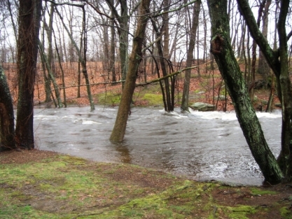
Emergency Management Agency
The East Providence Emergency Management Agency (EMA), housed within the Planning Department, plans and prepares for natural and manmade disasters. The agency serves as the City's Floodplain Coordination Office, educates the public, coordinates evacuations and the opening of shelters, and provides weather support for the City. City EMA works closely with other local, state and federal agencies including the RI Department of Health, the RI Emergency Management Agency (RIEMA), and FEMA on emergency management initiatives.
EMA News and Activity
Emergency Preparedness information is available on the Rhode Island Emergency Management Agency website. The FEMA preparedness webpage, http://www.ready.gov/make-a-plan offers assistance on preparing for many different potential hazards and for developing your own household emergency plan.
National Grid: To report a power outage, call 1-800-465-1212 during busy outage times. To report an odor of natural gas, call 1-800-640-1595. Below is a link to National Grid's Power Outage Map to follow along when there are outages in the area. When there are outages, the restoration times shown are subject to change, so use this with caution for short-term guidance.
https://www.nationalgridus.com/RI-Business/Storms-Outages/Outage-Map
The website for the National Weather Service (NWS) Office in Norton, MA, http://www.weather.gov/box , displays all weather watches and warnings for the southern New England area on a regional map and provides forecasts and discussions. The site contains links to to other NOAA weather-related sites. For local NWS Watch/Warning criteria, see this list of National Weather Service Warning Thresholds.
Hazard Mitigation Plan : The FEMA-approved East Providence Hazard Mitigation Plan is available at the link below. Comments are always welcome.
2017 East Providence Local Hazard Mitigation Plan
Red Cross Shelter: East Providence High School is the official Red Cross regional emergency shelter in a disaster. In times when a shelter is needed but demand will be limited, the East Providence Senior Center may be used.
Community Rating System: The City of East Providence is enrolled in FEMA's "Community Rating System" (CRS), which provides a discount on Federal flood insurance premiums for East Providence standard-rate policy holders. The discount for all standard-rate policies is 10%. Please call our office if you have any questions, or if you believe that the 10% discount is not reflected on your bill.
Additional Flood Insurance Information: All Rhode Island cities and towns participate in FEMA's National Flood Insurance Program, which allows residents and business owners to purchase Federally-backed flood insurance. FEMA's Floodsmart website includes clear and detailed information on this program. Our office is available to answer general questions on this program, including whether a property is in the FEMA 100-year floodplain, which particular zone it is in, and your nearby base flood elevation. We can also answer inquiries regarding other natural hazards, flood-related or not. Please contact us by e-mail listed above, or call (401) 435-7500 x11151 for more information.
Official Flood Insurance Maps: FEMA Map Service Center: http://msc.fema.gov/portal . Call us at the number at the top of the page if you need help using the Map Service Center website.
Floodplain Mapping Tool: Need a quick idea of what flood zone you may be in? Click here for the Rhode Island Flood Mapping Tool Tool from RI Emergency Management. Zoom in on East Providence and as you get closer in, the FEMA flood zones will appear. The regulatory flood zone is in dark blue. This is for reference only, but it's very accurate and a great place to start. Call our office at the number above if you need a flood zone determination.
Additional Preparedness Links:
Here is a link to our 2018 Hurricane Brochure.
Department of Homeland Security
Coastal flooding: FEMA and the Army Corps of Engineers worked with the City to produce the East Providence Hurricane Inundation Map, based on potential for tidewater flooding resulting from a direct hit from hurricanes of Categories 1, 2, 3 or 4.
City of East Providence Floodplain Ordinance (Adopted by City Council August 20, 2013): Chapter 19, Zoning; Section 19-306 through 19-315, Special Flood Hazard Areas.
FEMA Library-_Protecting Your Home and Property from Flood Damage : Mitigation ideas for reducing flood loss.
|